15% off ANY Self Drive Vacation Package - Book by June 15!
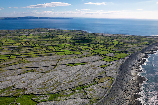
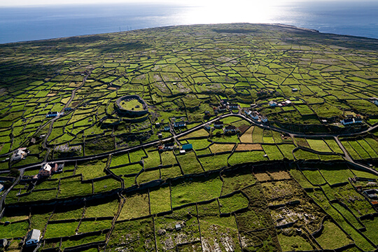
The Aran Islands are a group of three islands located at the mouth of Galway Bay, on the west coast of Ireland. The largest island is Inishmore the... See More
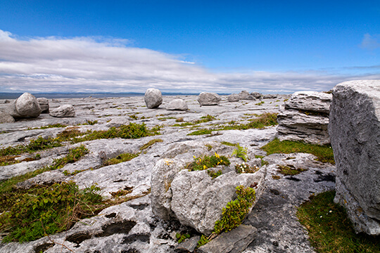
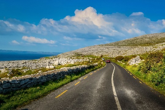
The Burren is a unique karst-landscape region in northwest County Clare, in Ireland and one of the largest Karst landscapes in Europe.
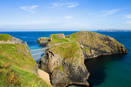
Carrick-a-Rede Rope Bridge is a rope suspension bridge near Ballintoy Co.Antrim Northern Ireland. The bridge links the mainland to the tiny Carrick... See More
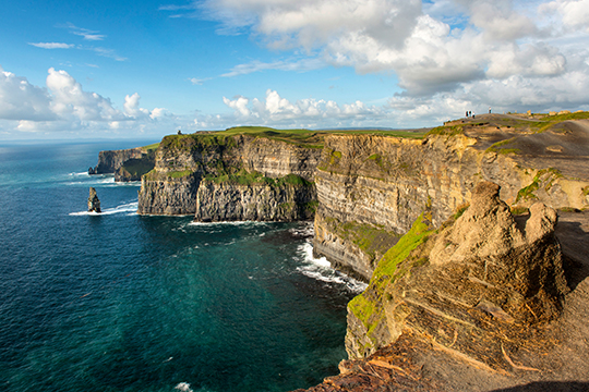
The Cliffs of Moher boast one of Ireland's most spectacular views On a clear day the Aran Islands are visible in Galway Bay as are the valleys and... See More
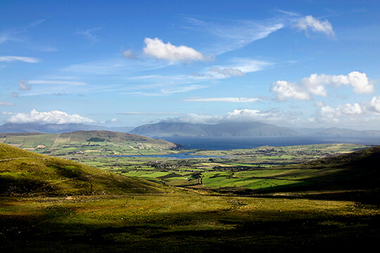
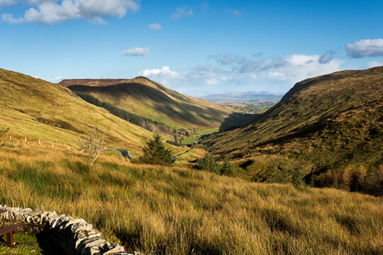
The Conor Pass is the highest mountain pass in Ireland. It is situated on the Dingle Peninsula in County Kerry, on the road that crosses the... See More
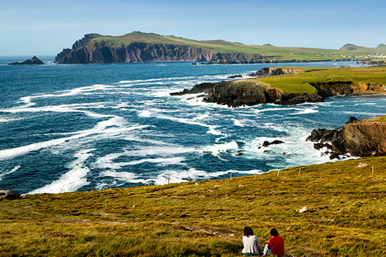
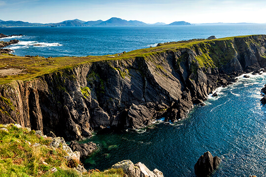
There are so many things to see, to do, to explore, to experience on the Dingle Peninsula . . . from almost 2,000 archaeological sites, to more... See More
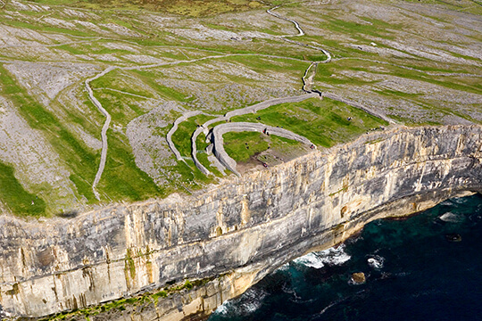
Dún Aengus is the most famous of several prehistoric forts on the Aran Islands, of Co. Galway. It was built during the Bronze Age and dates from... See More
The Gap of Dunloe is a beautiful glacial valley in the Macgillacuddy Reeks mountain range, which dominate the skyline of Killarney on the Ring of... See More
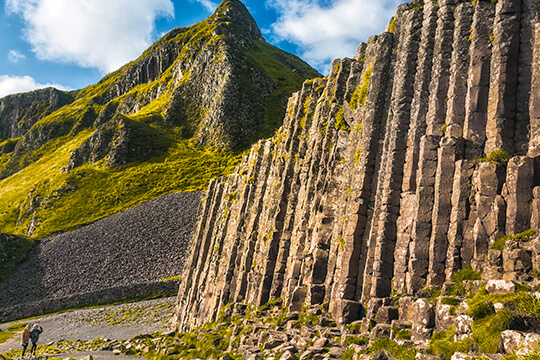
The Giant's Causeway is an area of about 40,000 interlocking basalt columns, the result of an ancient volcanic eruption. today is owned and managed... See More
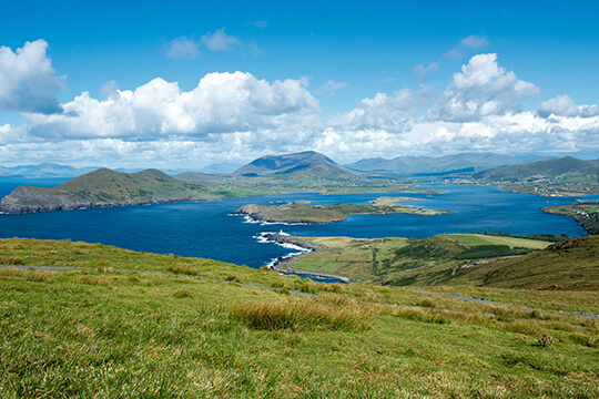
Admire breathtaking vistas of mountains, cliffs and beaches on Ireland’s most popular drive, the 100-mile Ring of Kerry.
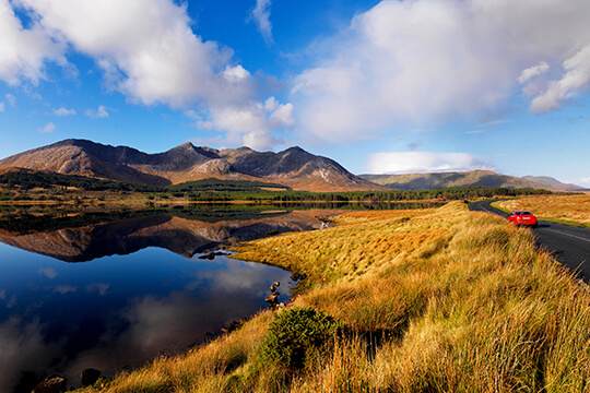
Connemara National Park is one of six National Parks in Ireland that are managed by the National Parks and Wildlife Service of the Department of the... See More
Croagh Patrick is the most prominent mountain overlooking Clew Bay on the Atlantic coast of County Mayo. Approaching it from the landward side to the... See More
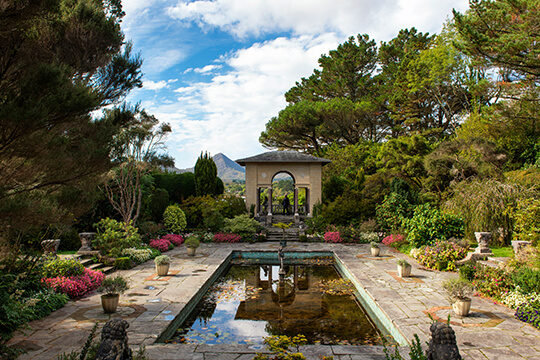
Garinish Island is set in Bantry Bay on the Beara Peninsula. The islands has 37 acres of gardens and is renowned for rich plant forms and varying... See More
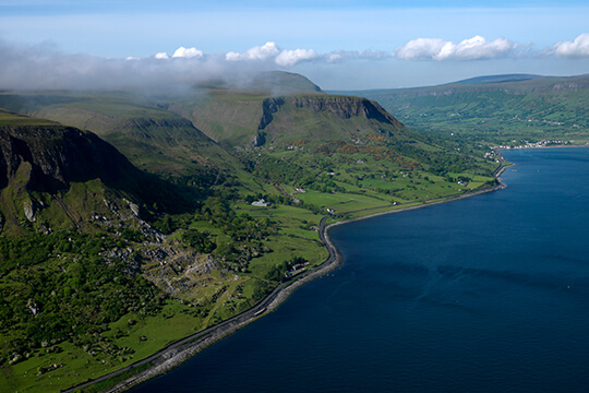
The Glens of Antrim on Northern Ireland's Causeway Coast are naturally unique - within twenty or so square miles you can enjoy a variations in... See More
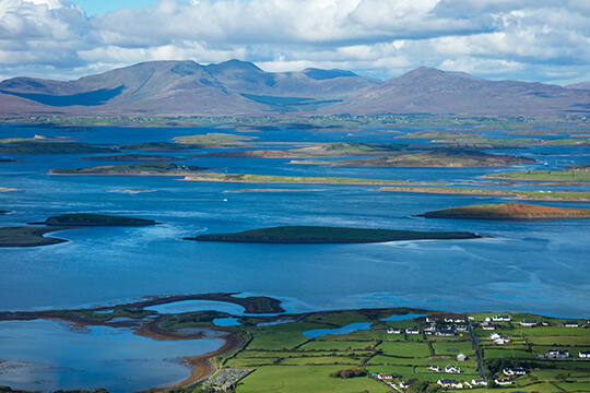
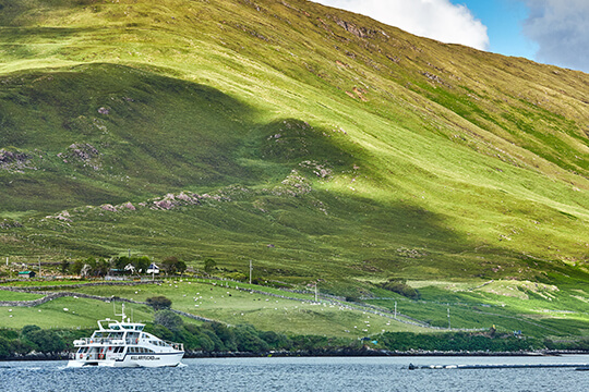
Kilary Harbour is located in Connemara. The Connemara Lady Catamaran is a wonderful way to see the fjord and surrounding area. The trip is often... See More
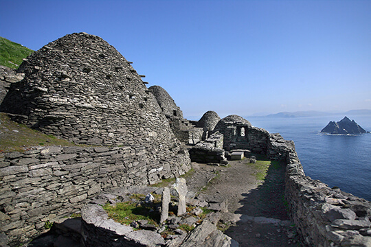
The Skellig Islands are two small, steep and rocky islands lying about 16 km west of Bolus Head on the Iveragh Peninsula in County Kerry, Ireland.... See More
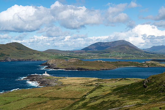
Valentia is one of great beauty & contrast and largest islands off the South West coast of Kerry joined to the mainland by bridge via the Portmagee... See More
Travel across the Curraun Peninsula to reach Achill Island, joined to the mainland by bridge. This area is steeped in history and despite its remote... See More
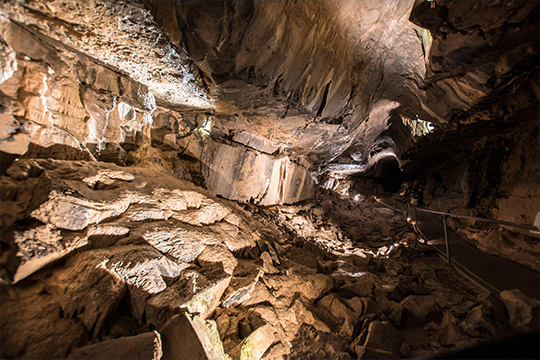
Aillwee Cave invites you to explore the wonders of this dramatic underworld. Expert guides will accompany and inform you as you stroll gently through... See More
The Ards Peninsula is a peninsula in County Down, Northern Ireland which separates Strangford Lough from the North Channel of the Irish Sea, on... See More
The Beara Peninsula is steeped in myths and legends. The mountains and valleys are rich in archaeological sites such as stone circles, wedge graves... See More
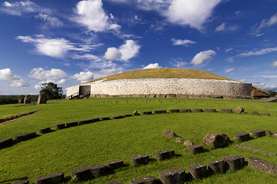
In Boyne Valley Visitor Centre you will learn about the burial tombs of Newgrange and Knowth, The Great Mound at Knowth is similar in size to... See More
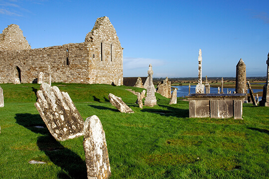
The monastery of Clonmacnoise is situated in County Offaly, Ireland on the River Shannon south of Athlone. Clonmacnoise was founded in 545 by Saint... See More
Doolin Caves is a limestone cave near Doolin in County Clare, Ireland, on the western edge of The Burren. The cave was discovered in 1952 by J. M.... See More
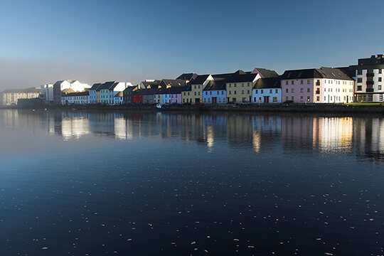
"Galway City itself sits on the river Corrib between Galway Bay and Lough Corrib and is the 4th largest city in Ireland and probably the most scenic.... See More
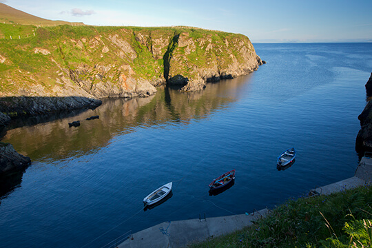
Glencolmcille or Glencolumbkille is a coastal town located on the southwest Gaeltacht tip of County Donegal. Gleann Cholm Cille is still an... See More
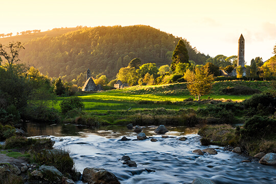
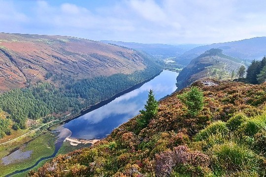
Glendalough is a glacial valley located in County Wicklow, Ireland, renowned for its Early Medieval monastic settlement founded in the 6th century by... See More
As you drive through the Glengesh Pass (Glen of the Swans) there is a sense of moving back through time, dotted along the route are old cottages,... See More
Experience the glorious natural beauty of the Grand Atlantic Drive, which winds through Downings and Rosapenna and past golden beaches and rocky... See More
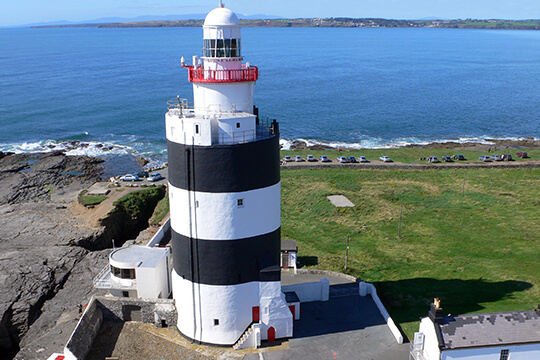
The Hook Lighthouse is situated at the tip of the Hook Peninsula in County Wexford, in Ireland, is one of the oldest lighthouses in the world.
The Inishowen 100 is one of the best scenic drives in Ireland and gets its name from the approximate distance in miles of the signposted drive, which... See More
Inis Meáin is the middle of the three main Aran Islands in Galway Bay on the west coast of Ireland. It is part of County Galway in the province of... See More
Malin Head is the most northerly headland of the mainland of Ireland. The most northerly point is actually a headland 2 km northeast of Malin Head,... See More
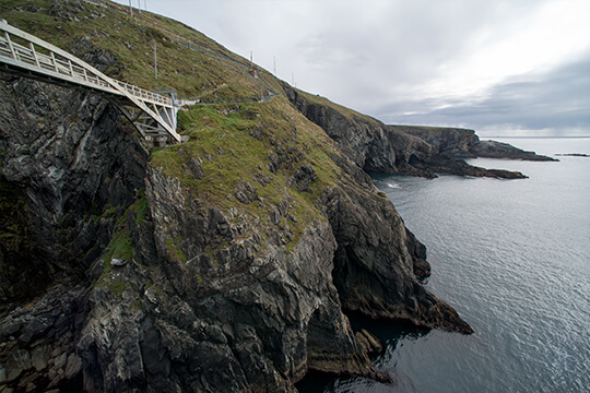
Mizen Head at the western extremity of the peninsula formerly known as the Ivagha Peninsula or Uíbh Eachach, is the south-westernmost point of... See More
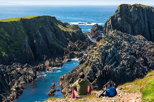
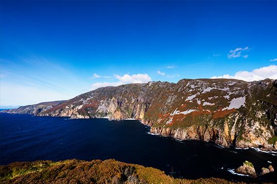
One of Ireland’s must see attractions, Slieve League Cliffs also known in irish as Sliabh Liag, situated on the southwest coast of Donegal, are said... See More
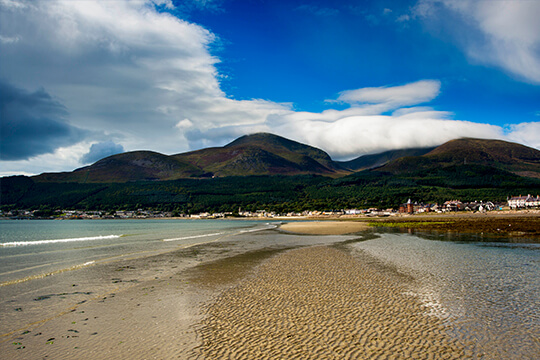
The Mourne Mountains are a granite mountain range in County Down in the south-east of Northern Ireland. The Mournes is an area of outstanding natural... See More
Explore Glendalough, Powerscourt, and Avoca in the stunning Wicklow Mountains—natural beauty, history, and adventure near Dublin await!
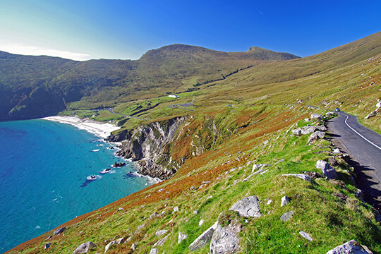
Discover the magic of the Wild Atlantic Way in County Clare, a truly unforgettable stretch of Ireland’s iconic coastal route.
Our Ireland based team is on call throughout your vacation!
Let's Start Planning Your Dream Trip!
One of our friendly travel experts will be in touch within 48 hours to help plan your unforgettable Ireland vacation
How much time do you have have to spend in Ireland?
20 Nights
Over 14 nights available on request.
What kind of experience are you looking for?
Castles
Customized
Faith
Family
Food & Dining
Golf
History & Heritage
Honeymoon & Romance
Knitting
Luxury
Pubs/Music
Scenic Attractions
Let us help you create that dream Irish vacation that you will remember forever.
Call us here in Ireland to discuss your plans.
USA & Canada Toll Free 1877 298 720 Australia Toll Free 1800 823 578 UK Toll Free 800 041 8833 International +35369 77686 Send us your enquiry
Sign up here to get the latest news, updates and special offers.